
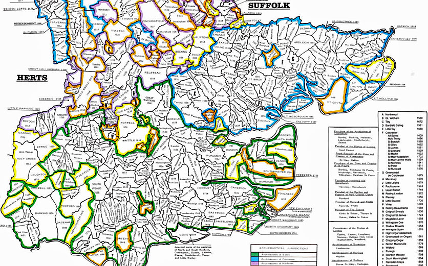
The Phillimore Atlas and Index of Parish Registers by Cecil R. Humphrey-Smith depicts the boundaries of parishes as they were before 1832. The book costs about £50, but the maps and index are worth the price.
The term "county" has more than one definition. As it pertains to Essex, it can refer to the historical county, the ceremonial county, or the postal county.
After 1832 the different county lines of Essex were redrawn, including subtractions given to Metroploitan London, Hertfordshire, and Cambridgehsire. The historcial county of Essex had the largest footprint.
When the adminstrative district of Greater London was established in 1965, parishes taken from Essex included Barking, Chingford, Dagenham, Honrchurch, Illord, Lyeton, Romford, Walthamstow, Wanstead, Woodford, and part of Chigwell. The pre-19th century records for these parishes are still housed in the Essex Record Office, Chelmsford.
We do not know what you know. Please share with us your knowledge, and help us correct any error you find in our research.
